Dec 22, 2013

This morning's crazy weather or why Andy has more grey hair!

Here is another "look" at this mornings "unbelievable" weather (freezing rain in some places, rain in others and temperatures below freezing in some spots with record warmth in others)!


The first image is a "normal" or "typical" temperature plot versus height - temperatures usually decrease with increasing height. The temperature plot slopes from the lower right of the SkewT to the upper left.  A SkewT is a thermodynamic diagram that enables one to plot temperature, moisture (and wind, too).

The temperature scale is at the horizontal axis at the bottom of the chart. Temperatures are colder to the left of this axis and warmer to the right. The horizontal scale is the height and pressure (above ground level). Pressure decreases with increasing height.


The image below to the lower right is a plot of the actual  temperatures and moisture aloft over Albany, NY (at 7AM EST/22 DEC). on a SkewT diagram.


The dashed red line is the dew point temperature. The red line is the air temperature. Note the temperature curve: it slopes from the lower left of the diagram towards the upper right. That is to say temperatures are INCREASING (NOT decreasing with height). The DEPTH or height of the cold air is BARELY 500 hundred feet thick!

The next image is an interval listing of the Albany data. Note the temperature at approximately 1,260 feet above the ground (at Albany) : +10.3° C or 51°F. This why the higher elevations are warmer than the valleys.


Why is that the Hudson Valley is colder? 


Well across southeast Canada and Northern NY State and New England there is a strong arctic high pressure system.  Thanks to a nearly perfectly aligned windflow from the NNE, as shown on the mesoplot below,


some of this very cold and dense air was able to "drain" down the Champlain Valley into the Lake George Basin then into the Hudson Valley.

Why does Andy have more grey hairs?


Because of all of the above!!

Oct 4, 2013

Another Update on Karen

Karen continues as a rather poorly organized tropical storm, battling the nemesis of many a tropical cyclone: strong wind shear and dry air. As shown below on the lower left image strong westerly shear of 20-25 knots continues across the cyclone and this is displacing the convection off to the east of the lower level surface circulation. The dry air is evident on the the water vapor satellite imagery (shown to the lower right) and is highlighted in the brown color. This dry air is drawn into the storm's circulation.


Based on the latest recon data from hurricane hunter aircraft, the storm has weakened a bit; the central pressure has risen (up to 1003 millibars) and the winds have decreased to 50 mph. The system is also wobbling on NW-NNW heading of around 10 knots or so. The dilemma facing the forecast is two-fold: 1) the future track and where it eventually makes landfall and 2) its intensity changes - will it continue to weaken, hold its own or perhaps intensify slightly before land fall.

A weaker tropical cyclone, being not well developed tends to be steered by winds in the lower levels of the atmosphere. Two of the four primary global models that are used in tropical cyclone forecasting - the UK and EC models are more west with the track of Karen. The other two models the GGEM (from Canada) and the GFS (the U.S. model) are more east with the GFS the farthest east and also indicating both a stronger and better organized tropical system. Based on the past motion of the storm the EC and UK appear to be doing better on the track and also the strength ( indicating a weaker cyclone). Because of this the tropical storm warning has been extended westward along the coast of Louisiana. This warning is now in effect from Grand Isle to Morgan City. The hurricane Watch remains posted for the moment from Grand Isle Louisiana to west of Destin, Florida but MAY BE discontinued later today or changed to a tropical storm watch or warning later today. So ultimately where Karen makes landfall is still up in the air at this point in time.

The system will ultimately make landfall over the weekend, over southeast Louisiana late Saturday then turning toward the northeast during Sunday as a non-tropical trough of low pressure approaches from the west.  The more west track would now favors the remnants of Karen being absorbed by the trough's cold front on Monday over the western part of South Carolina with the remnants of Karen moving northeast along the cold front as the front itself slides east to the East Coast by Tuesday.

Right now it looks like the heaviest rains of the combined cold front plus Karen's remnants will extend from the Southeast States to the eastern half of Virginia  and the Chesapeake Bay and the Delmarva Peninsula during the Monday-Tuesday time frame. While only moderate rains are forecast for now across Pennsylvania to NY State and western New England (most of this falling late Monday night into Tuesday).

More updates to follow


Oct 3, 2013

Some Quick thoughts on Tropical Storm Karen

The 11th named tropical cyclone of the season has formed over the Southeastern Gulf of Mexico - Karen. It was located about 500 miles south of the Mouth of the Mississippi River with maximum winds of 60 mph, and moving toward the northwest at around 13 mph. Karen is forecast to turn north and slow down over the next 24-36 hours as well as strengthen to a hurricane during this time. By Sunday, forecast environmental conditions will become unfavorable as the storm nears the U.S. Gulf Coast and some weakening is expected. Nonetheless Tropical Storm and Hurricane Watches have been posted for the Northern Gulf Coast.

(Current position and wind radii + Watches)
The forecast track of Karen (map below) has it nearing the Central Gulf Coast by early Saturday morning, October 5th and then making landfall over the western Florida Panhandle by Saturday afternoon.
(Official NHC forecast track for Karen)

Forecast model consensus is in fairly good agreement on the expected track of Karen. After landfall the system will weaken into a tropical depression and move a bit more quickly toward the northeast during Sunday through Monday of next week as it begins to interact with an expansive non-tropical area of low pressure that will extend from the Great Lakes to the Lower Mississippi Valley states. The remnants of Karen and this low pressure area will continue east and reach the East Coast of the U.S. by late Monday-Tuesday of next week. 

The early track guidance (map below and to the right) is clustering slightly to the east of the official NHC track forecast but again the early guidance is clustered around a landfall over the Florida Panhandle. 
(Early tropical cyclone guidance)

By early next week the interaction of Karen's remnants with the non-tropical low pressure area approaching from the west, could lead to widespread and potentially/possibly heavy rainfall for the Eastern States, especially from the Western Carolinas northward through the Mid-Atlantic States, Pennsylvania, interior central and eastern NY State and Western New England. I'll have more on this rain fall threat later today but I can say that there are numerous "signals" in the forecast data that favor some heavy rain for interior Eastern NY State and Western New England during early next week. How heavy? That is a question yet to be answered; then again we have been VERY dry as of late so any rain fall may actually be beneficial as long as its not EXCESSIVE.

Sep 5, 2013

Hug your Honey Weather Tonight

We are forecasting the season's first frost and/or freeze for some area for this overnight and early Friday morning. In general this "first" frost is a bit ahead of the average dates for a first frost. Here is a map of the average times for first frosts for NY State from Cornell University


For the Adirondacks of NY tonight's expected frost is fairly close to normal time of occurrence but for other locations that are under a frost advisory its about 10 days to 2 weeks sooner. Here is where freeze and frost warnings are posted for the NEWS10 viewing area:


Here are some of the low temperatures that we are forecasting for tonight for the Adirondacks, Mohawk Valley, Upper Hudson Valley and Vermont. By the way, the record low for September 6th for Glens Falls is 34° set in 2000, so there could be some record lows for that location

For the rest of the viewing area here are tonight's expected lows
The record low for Albany is 38° set in 1938 so we could take a run at this record if we calm out quickly over night. Below are the average dates for the first frost for a few select locations, including the earliest and latest dates for the occurrence of  the first frost. (Thanks to my colleague Steve Caporizzo for the images and data).


For the Adirondacks and Glens Falls the chances to get a first frost of fall before Sept 10th-14th period is 10% probability of occurrence; so this is indeed a rare occurrence and if it does happen, for some locations it could be the earliest occurrence date ever! Keep in mind that local climates can affect frost formation. For example, if a location is near a body of water then frost formation could be delayed or not happen at all due to the warming effects that that water body exerts locally. Conversely a valley  under the right conditions of no warming effects from a body of water, clear skies, calm winds and cold air drainage (from off the mountains surrounding the valley) can radiate heat efficiently at night and chill down quiet easily.

Now tonight's expected frost and/or freeze will have more of an impact on an individuals garden (like mine where I still have plenty of green tomatoes!) versus impacting fruit orchards like apples. As a matter of fact tonight's cold weather is actually good for the apples and should make for some fine picking very soon!


Quick Update on the Tropics

Activity has increased a bit over the Atlantic basin over the past few days. Here is the Thursday morning Tropical Weather Outlook from the National Hurricane Center:


 Late yesterday a Tropical Depression (#7) formed to the south of Puerto Rico and then briefly intensified into Tropical Storm Gabrielle late yesterday evening. Today the system has once again weakened into a poorly organized depression. The weakening occurred due to proximity to the islands in the Greater Antilles (namely Hispaniola) and strong winds aloft from the west causing shear. As I stated in my previous post on the tropics shear is an unfavorable element for tropical cyclone development.

As I also mentioned in my last blog post with the negative factors currently in place across the Atlantic for the moment only a few geographic locations over the basin favored potential development. One area that I mentioned was the Bay of Campeche. This morning an area of disturbed weather (satellite image to the left)  is showing some increase in organization and convection. There is a bit of shear aloft over the system at the moment but it is forecast to ease during the next 12-24 hours. As this disturbance moves W-WNW over the next 24-36 hours, there is a chance for it to become a tropical depression or a tropical storm before it moves onto the mainland of Mexico.

Lastly there is a 3rd area of showers and storms over the Eastern Atlantic to the west of the Cape Verde Islands. This is associated with a tropical wave. It is poorly organized with no signs of a closed low pressure circulation. Numerous negative factors - shear and SAL ( see my previous blog post to learn more about SAL) over the next few days will preclude any significant development of this system.

So as it stands now the Atlantic has had 7 named tropical systems and still NONE have become  hurricane.

Sep 1, 2013

Let's Hope it stays this way

The peak of the Atlantic hurricane season is approaching, the date is September 10th and so far we have not had ONE hurricane yet in the Atlantic basin. The last time there were no hurricanes in the Atlantic through this point in the season was 2002. Now the quietness of the season thus far is no guarantee that it will remain so thus we should not let our guard down but it is interesting nonetheless.

Why so inactive?

Thus far we have had five named tropical systems all of tropical storm intensity; this number is about normal for the number of named storms for this point in time in a hurricane season. One storm,  Andrea, made landfall on the U.S. mainland bringing beneficial rains to a drought  parched Southeast U.S.

A number of factors have come into play making for an inactive season so far:

First the Bermuda high a large area of high pressure that spans the Atlantic Ocean has averaged out to be a bit stronger than normal thus far this summer. Higher than normal pressure across the Atlantic is an unfavorable factor for tropical cyclone development.. (However I will point out that over the past week or so the overall strength of the high is weakening a bit). Another note about this high is that it is a bit farther south  of its "normal" climatological position,

Second, at times across the tropical latitudes of the central and east-central Atlantic a Tropical Upper Tropspheric Trough or TUTT has persisted; depending on the configuration of the trough, strong SW or W winds aloft have occurred over this part of the Atlantic. Both TUTTS and strong winds (shear) are unfavorable factors for tropical cyclone genesis or intensification.

Third blame it on SAL. SAL or Saharan Air Layer is a cloud of dust or better yet SAND from the Sahara Desert that moves westward off of the continent of Africa and then out over the Atlantic Ocean. There have been at least three occasions this summer where SALs have migrated all the way across the ocean to Texas! SAL and all that it carries with it - the warm, dry (stable) and sandy air are negative factors for tropical cyclone development.

Currently yet another SAL is moving off the west coast of Africa


So far through from June 1st the start of the Atlantic Hurricane Season through August 27 of this year, largely because of the SALs that have moved off of Africa, the average relative humidity over the Atlantic has been way below normal. (Keep in mind tropical cyclones "like" warm and moist air in and around their circulations NOT warm and dry air). Here is a map of the departure from normal of the mean relative humidity (from NOAA):

For more on SAL checkout: What is SAL .   So for at least the next week tropical cyclone activity should remain on the quiet side.

What areas are favorable for tropical storm formation?

Right now little shear and moist air is confined to a relatively small area of the Atlantic basin, namely the Western Caribbean Sea and the extreme south portions of the Gulf of Mexico(Bay of Campeche). If any tropical systems can move or form over these locations over the next few days conditions are "marginally" favorable for some possible development.

Some other interesting points

The least number of storms that has occurred in the Atlantic in any given Hurricane season is 4 (1983).

It has been been 7 years and 10 months since a major (category 3 or greater) hurricane has struck the U.S. This is the longest streak on record. The last time the U.S had a major hurricane make landfall was Wilma in 2005.

Between 1962 and 2012 (50 years) an average of 5.6 major hurricanes per decade made landfall on the U.S. For the preceding 50 years (1911 and 1961) an average of  8.4 major hurricanes struck the U.S.

Global hurricane activity has actually been in decline over the past 40 years (in spite of some active years in the Atlantic:

Let's hope it stays this way! ;-)

Jul 25, 2013

Dorian & "Friend"

As July draws to a close the Atlantic tropical cyclone season should be ramping up towards its peak by early September. Currently two systems are being monitored by the NHC. One is Tropical Storm (TS) DORIAN out over the eastern Atlantic and the other is a disturbance dubbed 99L over the west central Atlantic to the northeast of Bermuda.

99L is a weak surface low associated with  a stalled front well off the East Coast and an upper-air low aloft. It is in a rather "complex" atmospheric environment but it is located both south of the Gulfstream and over warm water with SSTs  at 26°C or warmer. The latest visible satellite loop for 99L shows a low-level cloud swirl near 35.2°N60.3°W but the higher top convective clouds are displaced to the north by east of this low level circulation by a distance of 45 miles or greater. The satellite signature has what I call a "thumb" look to it (place your thumb over the cloud mass you'll see what I mean), such a signature is associated with a weak, disorganized system and it is also an indicator of unfavorable shear over it. This noted, winds aloft are forecast to become more favorable for some development of this feature. While it is currently moving NNW it will turn N and then NE over the next 48 hours as it moves northeastward AWAY from the US coast. In a couple of days it will be moving over cooler SSTs which are a nemesis to tropical systems, thus weakening is expected.

As for Dorian it continues to hold its own. At 11 AM EDT it was located approximately 1800 miles to the east of the Northern Leeward Islands. It continues to rip along toward the WNW at about 18 mph as it remains south of the Atlantic subtropical high to it its north
Mean steering flow 850mb-500 mb Dorian located by RED X and ST high denoted by the light blue "H"

Maximum winds are  60 mph and Dorian has now moved past the region of cooler SSTs but it is in an area where the atmosphere is drier and should be in this environment for about the next 24-36 hours. While the official NHC forecast calls for some slight weakening during this time, I would not be surprised if it held steady in strength or even increased in intensity due to both the shear being less than forecast yesterday (on the order of 10-15 knots) and also the possibility for a poleward outflow channel developing over the system due to a "smaller" HIGH aloft over the tropical Storm.


To the right is a map of Dorian's location and track for the next few days with satellite derived/observed winds overlayed. The yellow wind barbs are for the high levels of the atmosphere between the 350 and 250 hPa levels. Note the anticyclonic (clockwise) flow at this level. High pressure areas aloft above a tropical cyclone are "favorable" for development.


As for he official NHC forecast track it has not wavered over the past day or so. A continued WNW motion is expected with a gradual decrease in its forward speed.

Barring any changes to the over all weather pattern across the Atlantic and to Dorian itself it would appear that the storm would pass north of both The Lesser Antilles, Puerto Rico and the Virgin Islands by late Sunday or early Monday of next week. It will also be passing to the south of the Hurricane Benchmark position of 25°N60°W; this is critical because storms that pass over or to the south or west of this point on a W, WNW or NW heading can pose a threat to the East Coast of the US. This threat can range from peripheral ones like rough seas and high long period swells and even rip currents to more serious impacts like heavy rain and or wind. Let me reiterate that I am NOT saying Dorian WILL MAKE landfall along East Coast, a lot can happen between now and next week, but if the trends continue as they are we will definitely have to watch this system.

Jul 24, 2013

What is a "backdoor" cold front?

Tropical Storm Dorian

The 4th named tropical cyclone of the season has formed over the far Eastern Atlantic this morning, its named Dorian.  It is moving rather briskly on west and slightly north track at 22 mph and was located about 310 to the SSW of the westernmost Cape Verde, Islands. Here is the latest IR satellite image.
IR Satellite picture from 945AM EDT 24 July of Africa with T.S. Dorian on the lower left 

As you can see from the satellite photo Dorian is a relatively small cyclone. Currently it is in an environment of low shear [ wind  speeds aloft < 20kts] and warm sea-surface temperatures [SSTs] of greater than or equal to 26°C, both favorable for some development. However once it moves west of approximately 35° W longitude environmental conditions will become less favorable as dry Saharan air will be close to the storm's circulation:


and wind shear will also be increasing: 


The above map shows the forecast track of Dorian along with the expected wind shear along it. Over the short term ( i.e., the next 24-36 hours) Dorian is expected to strengthen slightly with winds increasing to near 50 knots; then it is expected to weaken to a "minimal" tropical storm with winds staying near 40 knots as it moves over slightly cooler SSTs and eventually increasing westerly wind shear. However once it passes by the cooler water, SSTs warm to 26°C or greater (west of 43°W), thus the warmer waters below "may" offset the increasing share above, thus the call for Dorian to maintain tropical storm strength over the next 5 days.

Keep in mind that small tropical cyclones (the radii of Dorian's tropical storm force winds [34 kts/40 mph] extends only 40 nautical miles to the NE and 30 nautical miles to the SE of the center) can rapidly weaken, especially in less than favorable environmental conditions BUT they can also "survive" and hold there own, too because the small size can actually "allow" it to "avoid" these poor conditions.


Here is the current forecast track from the NHC for Dorian based on the 24 July 2013 11 AM EDT data:

Jul 17, 2013

Anatomy of a Heat Wave

Today will be the 4th consecutive day of 90°+ heat for Albany; we'll likely hit 90 or better on Thursday and Friday of this week, too. This is the longest hot spell for Albany since July 20-23, 2011; The last 5 day heat wave for Albany in 2011 (from the 5th through 9th) and the last 6 day heat wave was Aug 11th-16th, 2002.

Albany is currently in the midst of its 171st heat wave going back to 1820 when temperature records first started to be kept for the city (daily temperature & precipitation records started in 1874).

Remember a heat wave for us is defined as a stretch of 3 or more days in a row with an afternoon high temperature of 90° or higher.

Here is a breakdown of Heat Waves past for Albany
  • The longest heat wave EVER was 10 days spanning from Aug 27th through Sept 5th, 1953
  • This heat wave featured 2 days with an afternoon high of 100° on Set. 2nd and 3rd. (BTW- this was the last time Albany hit the Century mark).
  • The longest heat wave EVER was 10 days spanning from Aug 27th through Sept 5th, 1953
  • 10 and 9 day heat waves have occurred once each
  • 8 and 7 day heat waves have happened 3 times each
  • A 6 day heat waves have happened 10 times
  • A 5 day heat wave has happened 5 times in the past
  • A 4 day heat wave has occurred 32 times
  • A heat wave of 3 days has occurred 102 times in the past
Long duration heat waves have similar weather patterns. Of the 10 past, 6 day long heat waves for Albany I have randomly chosen 3 of  them and compositeted the surface map for them
Composite surface map for 6 day heat wave 6/29-7/4, 1887
Composite surface map for 6 day heat wave July 7-12, 1944
Composite surface map for 6 day heat wave July 24-29,1963

The dark contoured areas indicate regions of lower pressure. All 3 composite maps indiacte this thermal or heat induced low across the Southwest States and Intermountain West. The brighter shaded areas off both the Pacific and East Coast of the U.S. are the subtropical HIGH pressure areas. All these maps show the Pacific subtropical high to be very strong and situated to the north of its normal position. The Atlantic subtropical  (Bermuda) high is close to its normal position but features and "extension" to the northwest, that is towards the Ohio Valley and Great Lakes region. This northwest extension of the high allow for a westerly wind flow. Sinking air  is associated with a high pressure area. Sinking allows for the air to heat up, the addition of the westerly flow around the "extension" of the Bermuda high allows for additional localized warming of the air to occur across the valleys of the Northeast due to additional compression. Keep in mind when air sinks it both compresses and warms .

Any relief on the way?

Probably over the weekend a cold front will press slowly southeastward across the Northeast States. Once the front clears the area by later Sunday, less humid and cooler (more seasonable) weather will follow. This relief may come with a price - the cold front may cause strong even severe weather for the Northeast U.S. during the weekend.

Jul 13, 2013

May & June Precipitation Records

The months of May and June saw way above normal rainfall for much of the Eastern U.S. including Eastern NY State and Western New England. Below is a table showing the June total rainfall for Albany, Glens Falls and Poughkeepsie, as well as how these totals ranked in terms of historical wetness.

In addition the combined May and June totals are also given along with how these two consecutive months ranked in terms of historical wetness for two consecutive months.


LocationJune RainfallJune RankMay+June RainfallMay/June Rank
Albany8.68”3rd Wettest15.33”Wettest on Record since 1874
Glens Falls5.69”8th Wettest9.56”11th wettest; record is 12.83” set in 1998
Poughkeepsie9.82”Wettest Ever14.03”4th wettest on record; record wettest 19.02” set in 1989


As for the upcoming week our weather for most us should be dry weather through Wednesday. In addition it looks like another spell of haze, heat and oppressive humidity., perhaps even another heat wave. The 90° plus temperatures should commence on Sunday and last through Thursday. Also by next Thursday the threat for storms and showers returns to the region as a low pressure area and associated cold front approach the area. Depending on exactly when these systems move across the area on this day will determine whether or not we have any (widespread) severe weather. Whether the storms are severe or not is yet to be determined but I feel fairly confident that the prospects for locally heavy rain on Thursday,thanks to the amount of moisture that will be "over" us.

Jul 3, 2013

Why So Wet the past few weeks?

Needless to say our weather especially since the last half of May and much of June has been extremely wet. Many locations in the Northeast and Mid-Atlantic States have experienced rainfall MUCH above normal with some locations having record breaking amounts of rain. In Albany NY the monthly June rainfall was 8.68", which  was 4.89" ABOVE normal!. It was also the 3rd wettest June on record; precipitation records for Albany go back to 1826.

Our wet weather pattern can be tied to an abnormal upper-air pattern called a block that persisted across North America, from  the Central Pacific to the central Atlantic. An atmospheric "block" is when weather systems, usually high pressure cells become very large in size both at the ground and aloft. Thus they tend not to move or move very little. Blocks cause "persistence" type weather; that is depending on what part of the block you are located your weather can either be dry or nice, or unsettled.

Normal mid-June Weather vs Mid June 2013 actual weather
First let's look at the upper-air pattern for the period June 15th through June 30th. Here is what the "normal" 500 hPa constant pressure chart (approx 18,00 feet ) above the ground would look like for this period:
Normal 500 hPa heights for period 15th-30th June
A constant pressure chart is are really a topographic map of the atmosphere. The height lines or contours  indicate how high above the ground the pressure of  in this case 500 hPa is observed.  The higher the height at this level (in the case of the colors the brighter yellows to oranges and reds) the higher up one must go to record a pressure of 500 hPa; these contours indicate HIGHER pressure aloft. Conversely the cooler colors down to the purples indicate LOWER pressure aloft. So normally during the period of June 15th through 30th. A large area of high pressure (aloft) prevails across much of the Lower 48 states with the jetstream north of the International Border. The very brighter oranges and reds over both the Atlantic and Pacific Oceans are associated with the semi-permanent subtropical high pressure cells. The contours can also approximate the wind flow too. The winds tend to blow parallel to the contours. So a general west to east wind ("zonal" flow)  would be the expected norm for this period.

Now lets take a look at the anomaly of the 500 hPa for June 15th-30th, 2013(map below). It shows how the weather pattern for the last 15 days of June 2013 deviated from normal ( that is how it deviated from the "normal" chart shown above).
500 hPa Composite Anomaly for period June 15-30, 2013
The darker colors indicate lower than normal "heights", while the brighter greens to yellows and reds indicate higher than normal heights. From this chart we can infer the following: across Texas and the Southwest States through the Rockies and High Plains and over the Atlantic to the east of New England and the Canadian Maritimes there are two areas of HIGH pressure which averaged out stronger than normal for this time period.  Between these two systems we have an elongated trough of low pressure aloft (strongest over) from  Quebec Province extending southwestward across NY State to the Ohio Valley. Again we can use the anomaly contours to approximate wind flow; Thus to the west of the Atlantic anomaly and also to the east of the trough over Canada and the U.S. we have a southerly flow of air. These two features acting together  were able to pull very moist tropical air from out of the Gulf of Mexico and Atlantic over the Northeast States.

Below is a chart for normal values of precipitable water (pw) for the period 15th-30 June.
Normal precipitable water (pw) for period 15-30 June


Now let's look at the pw anomaly for June 15-30, 2013. This chart shows that during the last 15 days of June 2013 pw values were 2 to 4 standard deviations above normal. 
pw anomalies for June 15-30, 2013
Thus any low pressure systems or disturbances that affected the area would be capable of producing HEAVY rainfall. 
Anomaly of surface pressure for period June 15-30, 2013
The normal sea level pressure map for this period would feature relative high pressure for much of the eastern half of the United States. However for the period of June 15-30, 2013 as shown in the map above, a large area of BELOW (-2 to -3) sea-level pressure anomalies extended from the Texas Panhandle northeastward across the Upper Midwest, Great lakes, Ohio Valley and the Northeast states. It was within this region of below normal surface pressure that several low pressure systems formed and/or tracked. These disturbances lead to the periods of heavy rainfall.

What is in store for the start of July

 Here are the initial surface maps and 500 hPa charts from the July 3rd 8PM EDT computer models:
Initial Model Conditions for 3 July 2013 8PM EDT

The black lines are isobars (surface pressure) and the colors are height contours for 500 hPa.

Below is the forecast from the various computer models for 8PM July 4th.

48 hour forecasts from GEM-GBL'GFS/ECMWF/UKMET models valid for July 4th, 2013 8PM

Compare the red areas on these forecast maps to the initial model conditions. The forecast data is indicating that the blocking weather pattern is both (slowly) weakening and retrograding or if you will shifting to the west. The trough aloft is forecast to shift to the center of the nation while the offshore high gradually builds over us. As this high begins to increase its influence on our weather we should see decreasing rain threats over the next 4-5 days; any rain that does occur will be rather scattered and perhaps locally heavy, in addition our temperatures will be warming up too with the chance for some 90° + days through the upcoming 5 days or so. 

Jun 29, 2013

The June 27th-28th Mohawk Valley Flash Flood Event

The very wet weather pattern continues across The Northeast and Mid-Atlantic States and it is not done with us just yet.

The anomalous pattern of moist tropical air flowing from the Gulf of Mexico and the Southwest North Atlantic Ocean up the East Coast to the Northeast is one reason why it has been so wet this month (and even last month, too).  Below is the GEFS (Global Ensemble Forecast System) forecast map for the forecast winds at 850 hPa and the +2 to +4 Standard Deviation (SD) of the wind at this level; the map is for late afternoon of the 27th.


The water vapor in the air was way  above normal for this time of year, with  SD values of +2 to +3 SD as shown in the map below.


When this moisture interacted with a strong low pressure system (for the time of year) then the rain was both widespread and very heavy especially when embedded convection occurred within the storm's rainshield.


The map to the riggt is the GEFS forecast map for the early morning of June 28th. The low pressure system was over Pennsylvania with a pressure anomaly of  -3 Standard Deviations (SD)  BELOW normal for late June.

The June 27th 8PM EDT sounding for Albany, NY is below. [ A sounding is a radiosonde that records temperature, moisture and wind speed and direction above the ground. Soundings are very useful in daily weather forecasting; the information from them can be used to:  forecast maximum temperature or precipitation type or amount; assess instability in the atmosphere (which is helpful in thunderstorm forecasting) to name but a few ways that this information can be used]. The analysis of this data [temperature trace is in red, dew point (moisture) data in dashed green and the wet bulb solid lighter green ] indicated that the airmass above Albany was convectively unstable and very moist from the ground up through a great height.  The sounding also indicated that the warm air extended above twenty thousand feet. This is significant; case studies of past flash flood events for the Eastern U.S., especially for areas east of the Appalachians, showed that heavy rain producing convection occurs with very warm air aloft. Cloud top temperatures of these convective cells are warmer than -62°C. This "warm topped" convection that formed combined with both larger scale and mesoscale features all interacted in time and place to cause maximum precipitation efficiency and the resulting heavy rainfall. [1]

While thunderstorms were forecast they would not be severe; however thunderstorms and embedded convective showers within the storm's rain area would likely produce downpours due to the warm and moist nature of the air. Various indices also indicated the instability of the air and supported heavier showers.


The Convective Hazards Assessment Program (CHAP) (aka Ricks Index or RI) is another analysis tool that uses from data soundings to assess both severe storm potential and for forecasting potential rainfall amounts.  The CHAP [2] analysis (not shown) indicated NO severe thunderstorm; the rainfall calculator (a part of the CHAP), indicated 4.76" of rain with a maximum potential rainfall of 5.58"  was possible.

The heaviest rains fell across the Western Mohawk Valley and Southern Herkimer County of NY State. Note the rain totals at Ilion, Little Falls, and Columbia Center and compare it to the CHAP  forecast precipitation.


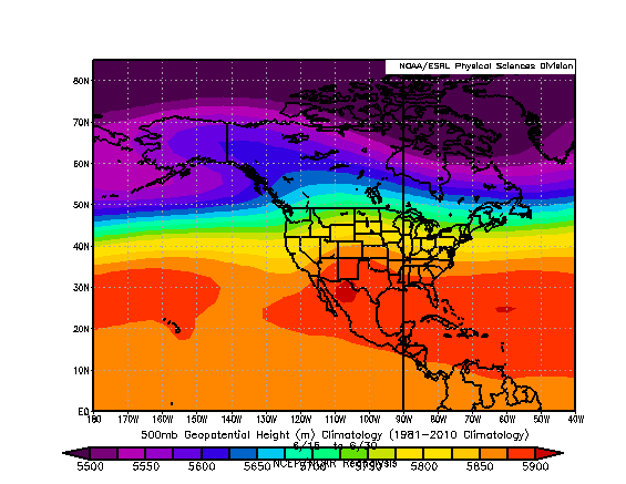
The surface pressure anomaly, 850 hPA wind data and anomalies and the 500 hPa heights and anomalies (data not shown) indicated the threat for a flooding rain storm was quite likely. The use of ensemble and anomaly data is a very useful tool in forecasting "abnormal" or "extreme" weather events. If all the weather elements of moisture, wind and lift are forecast to come together in time and place and the anomaly data indicates these features have a significant deviation from normal  then the forecaster has a higher confidence in the outcome of the forecast and can even assign a probability of the event occurring..

This flash flood event "fit" a Gulf (of Mexico)/Tropical (moisture) Origins event type. [3]

Other Factors that  caused the Flash Flood [4]
  • Wet antecedent conditions across the Upper Mohawk River and the Western Mohawk Valley
  • The slope of the Western Mohawk Valley is very STEEP from the Adirondack Mountains to the north and the Mohawk Valley
  • Clay soil
  • Land use - Southern Herkimer County and Western Montgomery & Fulton Counties are farmland with some light industrial development
References:

[1] Flash Flood Forecasting: An Ingredients-Based Methodology, Doswell, et al. Weather and Forecasting, December 1996/Vol. 11

[2]  Convective Hazards Assessment Process: Revised Ricks Index,  Ricks & Erickson AMS Storm Conference Preprints 2008

[3] The Use of Ensemble and Anomaly Data to Anticipate Extreme Flood Events in the Northeastern United States, Stuart and Grumm National Weather Digest

[4] From NWS Albany NY   Seminar for Broadcast Meteorologists May 2013

Jun 27, 2013

Very Heavy Rain + Thunderstorms = Flood Threat

Once again we are dealing with more rain this Thursday Night into Friday morning and it could be VERY heavy. All the atmospheric elements appear to be coming together in both time and place for an intense period of rain falling across Eastern NY State and Western New England during Thursday Night (June 27th) through Friday Morning (June 28th). The heaviest rain is expected to fall during late Thursday Night through early Friday AM. The rain is associated with anomalously "deep"/strong area of low pressure over southwestern Pennsylvania.
Surface Map Northeast US
Here is a forecast map of the low for early Friday morning (6/28/2013) and also how "unusually" low the central pressure of the low is for late June. The pressures at the surface with this feature are -2 to -3 standard deviations BELOW normal.


And it is already causing an expansive area of rain, heavy across PA and Central and Eastern NY State.
Albany Radar 9:44 PM 6/27/2013
A flow of air from the south, from near the surface up through 500 hPa,  (with the air moving over us having "originated" from the Gulf of Mexico and Southwest North Atlantic Ocean), is laden with an anomalously high moisture content. 
To the left is a forecast chart of the precipitable water (PWAT) along with its "departure from normal". The PWAT chart shows water vapor in the atmosphere over for early Friday morning running 2-3 standard deviations above normal.


When combined with the "stronger than normal" southerly wind flow aloft (chart to right) with standard deviations of +3 to + 4 and the unusually "deep" low pressure system moving across the area tonight we have the ingredients for a heavy rain event coming together in both time and place.

The combination of "unusual" departures from normal with surface  features, upper air features and thermodynamic features (PWAT) both observed and forecast all fit the consensus of a summertime heavy rain event. 


The probability for at least an inch of rain across Eastern NY State over the next 18 hours or so is high (likely) 70-80% . [Map to right]

As for actual forecast rainfall amounts many factors will come into play. Not only all of the above anomalous features but also local affects like orography (terrain) with a SSE flow higher elevations across the east facing slopes of the Catskills, the Berkshires and Greens, as well as the southern and southeastern Adirondacks and across the Taconics will get enhanced rainfall amounts due to the flow of the moist air being nearly perpendicular to these mountain ranges. Also embedded convection - thunderstorms will increase rainfall amounts locally. There is the potential for hourly rainfall rates throughout the region on 1"-2" / hour over night tonight into Friday morning. The rain will taper off from south to north during Friday morning. Due to the expected heavy rainfall during early Friday morning the potential for FLASH FLOODING is HIGH! Then as the rain tapers off from south to north between 8AM and Noon Friday, the potential for river flooding across Central and Eastern NY into Western New England is high. River flooding happens due to runoff from smaller streams and the higher terrain working its way into the larger and/or main stem rivers. This river flooding will be most likely to occur during late Friday morning through late Friday night or Saturday.  

Map to the left is the expected total rainfall for the Northeast from HPC  by 8PM Friday evening June 28th. I think its not high enough across the higher terrain of Eastern New York and Western New England where I am forecasting 2-4 inches, even some point/spot amounts to 5" not out of the question. Across the Hudson Valley a solid 1-2 inches is expected  (with a few spot 3 inch amounts possible).  Because of tonight's and Friday's expected heavy rainfall a FLOOD WATCH has been posted for much of the Northeast, including Eastern NY State and Western New England.

Be safe everyone! Remember if you are driving and encounter a water covered road TURN AROUND! DON'T DROWN.